
Wind speed is the average over several minutes. A gust is a short peak, usually measured over three seconds. Gusts commonly run 30 to 50% above the average, and more in showers, between buildings and in hills. Plan around the average for comfort and effort, and around the gusts for anything that can be blown over, torn or knocked off course.
Sustained wind and gusts are measured differently
Wind never blows at one speed. It surges and slackens every few seconds, so weather services report two numbers.
- Sustained wind (or simply "wind speed") is the average over a set time: 10 minutes in most of the world, 2 minutes at United States weather stations.
- A gust is the highest short burst in that period, normally a 3-second average.
A forecast of "wind 25 km/h, gusts 45" therefore means: mostly around 25, with brief pushes to 45. Both numbers are measured 10 metres above open ground, so street level in a sheltered town is usually calmer, and an exposed hilltop or a bridge is windier.
Why gusts happen
- Turbulence. Buildings, trees and hills break smooth airflow into swirls. The rougher the ground, the gustier the wind.
- Daytime mixing. Sun-warmed air rises and drags faster wind down from above. This is why afternoons are gustier than nights.
- Showers and thunderstorms. Rain-cooled air falls and spreads out along the ground. The strongest gusts of a storm often arrive just before the rain.
- Fronts. A passing cold front brings a sudden change of direction and a burst of gusts.
- Funnelling. Wind squeezed between tall buildings or through a valley speeds up, sometimes dramatically.
The Beaufort scale, in plain numbers
The Beaufort scale turns wind speed into things you can see. It was written for sailors in 1805 and is still the quickest way to make sense of a forecast.
| Force | km/h | mph | What you notice |
|---|---|---|---|
| 0 · Calm | under 1 | under 1 | Smoke rises straight up. |
| 1–2 · Light | 1–11 | 1–7 | You feel it on your face. Leaves rustle. |
| 3 · Gentle | 12–19 | 8–12 | Leaves and small twigs move all the time. Flags extend. |
| 4 · Moderate | 20–28 | 13–18 | Dust and paper lift. Small branches move. |
| 5 · Fresh | 29–38 | 19–24 | Small trees sway. Cycling into it is hard work. |
| 6 · Strong | 39–49 | 25–31 | Large branches move. Umbrellas are a struggle. |
| 7 · Near gale | 50–61 | 32–38 | Whole trees move. Walking against it takes effort. |
| 8 · Gale | 62–74 | 39–46 | Twigs break off. Driving is affected. |
| 9 · Strong gale | 75–88 | 47–54 | Branches break. Roof tiles and fences can go. |
| 10 · Storm | 89–102 | 55–63 | Trees uprooted. Considerable damage. |
| 11 · Violent storm | 103–117 | 64–72 | Widespread damage. |
| 12 · Hurricane force | 118+ | 73+ | Devastation. |
Which number to use for what
| Activity | Watch | Rule of thumb |
|---|---|---|
| Walking, running | Average | Above 30 km/h (19 mph) it becomes tiring. Cold wind also lowers the feels-like temperature. |
| Cycling | Both | The average sets your effort. Gusts from the side above 40 km/h (25 mph) can push you across the road. |
| Flying a drone | Gusts | Most small drones struggle above 30 to 35 km/h (about 20 mph). Wind is stronger at height than on the ground. |
| Garden furniture, trampolines, tents | Gusts | Secure things when gusts above 50 km/h (30 mph) are forecast. |
| Driving a van, towing | Gusts | Take care above 60 km/h (40 mph), especially on bridges and open roads. |
| Sailing, paddling | Both | Gusts decide how much sail you can carry. Direction decides whether you can get home. |
Reading wind direction
Wind is named for where it comes from. A north wind blows from the north and usually brings colder air in the Northern Hemisphere. Direction is also given in degrees: 0° or 360° is north, 90° east, 180° south, 270° west.
Direction matters as much as speed. An onshore wind brings damp sea air, a wind off the mountains can be warm and dry, and a change of direction is often the first sign of a front. Wind also turns with pressure systems: in the Northern Hemisphere, stand with your back to the wind and the low pressure is to your left.
Wind in Magic Weather
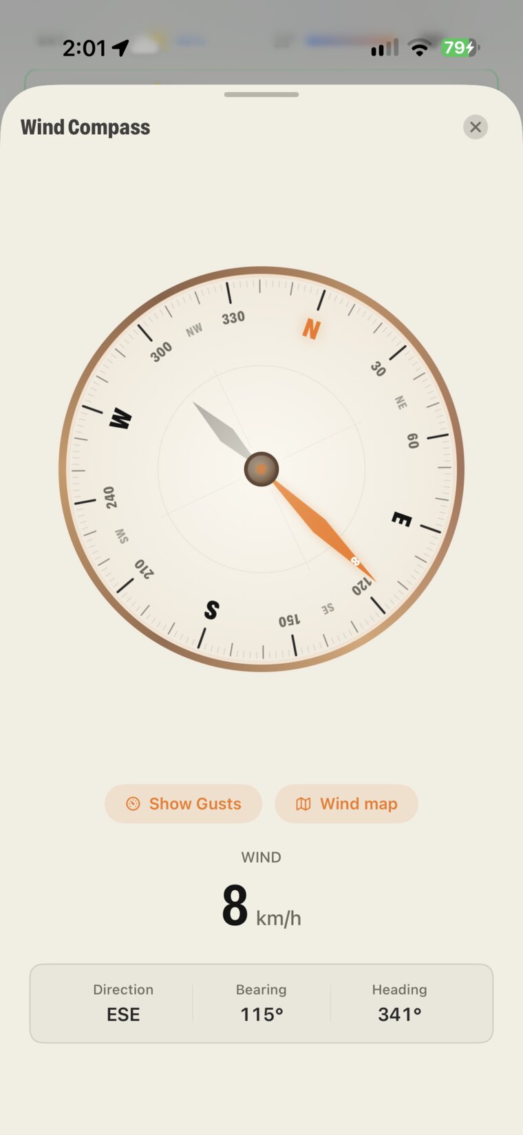
- The Wind tile shows speed, direction and a live compass. A Gusts chip appears when gusts matter. Tap the tile for the full-screen compass.
- The weathergraph draws wind as a dashed line with arrows through the week, and labels the windy peaks.
- Open any day and choose Wind to see it hour by hour.
- The Earth tab has a Wind layer that shows the flow over the whole planet, and the Radar tab adds wind and sea wind maps.
- Units are your choice in Settings › General: km/h, mph, m/s or knots.
Common questions
What is considered a strong wind gust?
Gusts above about 50 km/h (30 mph) make walking awkward and can move unsecured objects. Above 75 km/h (45 mph) branches break and driving high-sided vehicles becomes risky. Above 90 km/h (55 mph) expect structural damage.
How much stronger are gusts than the average wind?
Over open, flat ground gusts are typically 30 to 50% stronger than the sustained wind. In cities, hills and thunderstorms the difference can be 100% or more.
Does a west wind blow to the west?
No. Wind is named for the direction it comes from. A west wind blows from the west toward the east.
Why is it windier in the afternoon?
The sun heats the ground, the air near the surface rises and mixes with faster air from higher up. That brings stronger and gustier wind down to street level, usually peaking in mid-afternoon and easing after sunset.