
Fog forms when air near the ground cools to its dew point, so water vapour condenses into tiny droplets that hang in the air. The classic recipe is a clear sky, light wind and damp air after sunset. If the evening temperature is within about 2 °C (4 °F) of the dew point and the wind is nearly calm, expect fog by morning. By definition, fog means visibility below 1 kilometre.
What fog is
Fog is a cloud at ground level: billions of water droplets so small that they float. Each is about a hundredth of a millimetre across. They scatter light in every direction, which is why fog looks white and why headlights on full beam make it worse.
Weather services grade it by how far you can see.
The recipe: cool the air to its dew point
Air always contains some invisible water vapour. The dew point is the temperature at which that vapour starts to condense. Fog forms when the air near the ground reaches it, in one of two ways: the air cools down, or more moisture is added.
Three ingredients make the classic foggy morning:
- A clear sky, so the ground can radiate its heat away to space.
- Light wind, under about 10 km/h. A complete calm gives only dew. A gentle drift stirs the cold layer just enough to build fog. Stronger wind mixes in drier air and prevents it.
- Moist air near the ground, after rain, near water, or over damp fields.
The four main types
| Type | How it forms | Where and when |
|---|---|---|
| Radiation fog | The ground cools overnight and chills the air above it. | Inland valleys and plains, autumn and winter, clear calm nights. Burns off after sunrise. |
| Advection fog | Warm, moist air moves over a cold surface. | Coasts and cold seas. Can arrive at any hour and last for days. San Francisco's summer fog is the famous example. |
| Upslope fog | Moist air cools as it is pushed uphill. | Windward slopes of hills and mountains. What walkers call "being in the cloud". |
| Steam fog | Cold air passes over much warmer water, which evaporates into it. | Lakes and rivers on cold autumn mornings. Thin, wispy and shallow. |
Freezing fog is any of these when the temperature is below 0 °C. The droplets stay liquid until they touch something, then freeze on contact, coating roads, trees and wires in white rime.
How to tell the evening before
- Compare temperature and dew point at dusk. If they are within about 2 °C (4 °F) and the night will be clear, fog is likely.
- Check the wind. Under 10 km/h overnight favours fog. Above 15 km/h makes it unlikely.
- Check the sky. Cloud acts as a blanket and keeps the ground warm. A clear forecast after a damp day is the warning sign.
- Look at the pressure. High pressure in autumn and winter brings exactly these conditions, night after night.
- Know your ground. Valleys, river plains and low fields fog first. Hilltops often stay clear above it.
When fog lifts
Radiation fog usually clears from the edges inward and from the ground up. After sunrise the sun warms the ground, the lowest air warms and starts to mix, and the fog thins into low cloud before breaking. In spring and autumn that takes two to three hours.
In midwinter the sun may be too weak. Under a strong high, a layer of cold air becomes trapped beneath warmer air above, an inversion, and the fog can sit in a valley for days while the hills above enjoy sunshine. The same lid traps pollution, which is why air quality often worsens during long foggy spells.
Fog also clears when the wind picks up, or when a front arrives and replaces the air.
Driving in fog
- Slow down until you can stop within the distance you can see.
- Use dipped headlights, and fog lights when visibility is below 100 metres. Full beam reflects off the droplets and blinds you.
- Leave a bigger gap. Fog hides brake lights until late.
- Expect patches. Fog is rarely even. Dips and river crossings are the worst spots.
- Below freezing, assume ice. Freezing fog leaves a thin, invisible glaze on roads and bridges.
Fog and visibility in Magic Weather
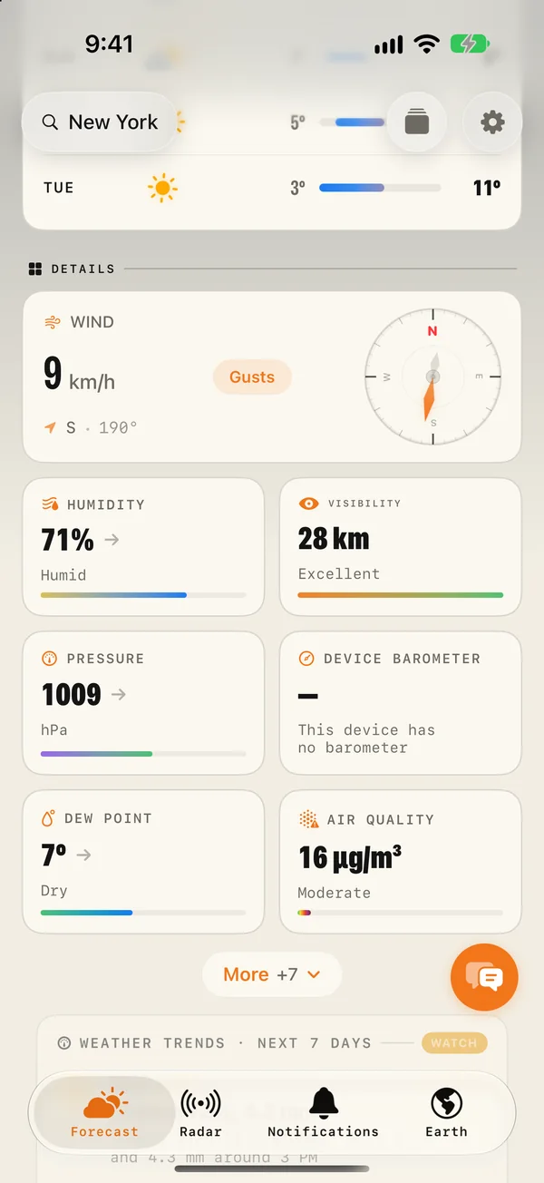
- The Visibility tile shows how far you can see, rated from very poor to excellent. Tap it for the hour-by-hour timeline to see when it drops and when it recovers.
- The Dew point tile sits nearby. Compare it with the evening temperature, as described above.
- The weathergraph draws fog into the sky at the hours it is expected.
- The Wind tile and the hourly wind chart tell you whether the night will be calm enough.
- Fog, frost and black ice alerts are among the experimental notifications in the Notifications tab.
Common questions
What is the difference between fog and mist?
Only the visibility. Both are tiny water droplets suspended in the air. It is called fog when you can see less than 1 kilometre and mist when you can see further than that.
Why does fog form in the morning?
The ground loses heat all night and is coldest around sunrise. The air touching it cools to its dew point at about that time, so fog is thickest in the hour or two around dawn.
When does fog lift?
Usually within two to three hours of sunrise in spring and autumn, as the sun warms the ground and the air starts to mix. In winter, under high pressure, fog can last all day or for several days.
Is fog more common near water?
Yes. Rivers, lakes and the sea add moisture to the air, and cold water cools warm air that passes over it. Valleys also collect fog because cold air drains downhill overnight.