
Hurricane categories come from the Saffir-Simpson scale, which ranks a storm from 1 to 5 by its highest sustained wind. Category 1 starts at 119 km/h (74 mph) and Category 5 at 252 km/h (157 mph). Category 3 and above are called major hurricanes. The category says nothing about rain, storm surge or the size of the storm, and water causes most hurricane deaths.
The Saffir-Simpson scale
A tropical cyclone earns a name when its sustained winds reach 63 km/h (39 mph), and becomes a hurricane at 119 km/h (74 mph). From there, the Saffir-Simpson Hurricane Wind Scale sorts it into five categories by its highest one-minute sustained wind.
| Class | km/h | mph | Typical wind damage |
|---|---|---|---|
| Tropical depression | up to 62 | up to 38 | Heavy rain. Little wind damage. |
| Tropical storm | 63–118 | 39–73 | Branches down, some power cuts. Flooding rain is the main risk. |
| Category 1 | 119–153 | 74–95 | Roof, gutter and siding damage. Trees toppled. Power out for days. |
| Category 2 | 154–177 | 96–110 | Major roof damage. Many trees down. Power out for days to weeks. |
| Category 3 | 178–208 | 111–129 | Devastating. Roof decking lost. Water and electricity out for weeks. |
| Category 4 | 209–251 | 130–156 | Catastrophic. Roofs and walls fail. Areas uninhabitable for weeks or months. |
| Category 5 | 252+ | 157+ | Catastrophic. A high share of framed homes destroyed. |
Categories 3, 4 and 5 are called major hurricanes. Damage does not rise in even steps: the force of the wind grows with the square of its speed, so a Category 4 does many times the damage of a Category 1.
What the category leaves out
The scale measures wind and nothing else. Three things it ignores are often more dangerous.
- Storm surge. The wind pushes the sea ashore as a rise in water level that can reach several metres. Surge depends on the storm's size, speed and the shape of the coast as much as on its category. It has historically been the leading cause of hurricane deaths.
- Rain. Rainfall depends on how slowly the storm moves, not how strong it is. A stalled tropical storm can drop more than a metre of rain.
- Size. A large Category 1 can affect far more people than a compact Category 4.
Taken together, water accounts for the large majority of deaths from tropical cyclones. The category is a guide to wind damage, not a full measure of danger.
Reading a forecast track
Storm maps show a line of forecast positions, often inside a widening shape called the cone of uncertainty.
- The cone shows where the centre may go, not how big the storm is. It is drawn so that the centre stays inside about two thirds of the time. One time in three, it goes outside.
- It widens with time because track forecasts are less certain further ahead, not because the storm is expected to grow.
- Impacts extend well beyond it. Hurricane-force winds can reach 150 kilometres or more from the centre, and rain bands much further.
- Intensity is harder than track. Forecasts of where a storm will go have improved greatly. Forecasts of how strong it will be, especially rapid strengthening, remain difficult.
Pressure: the other measure of strength
Forecasters watch a storm's central pressure as closely as its winds. The lower the pressure, the stronger the storm tends to be. A strong hurricane may have a central pressure below 950 hPa, against a normal sea-level value of 1013. The lowest ever measured was 870 hPa, in Typhoon Tip in 1979. More on reading pressure.
Hurricane, typhoon, cyclone
These are one kind of storm with three regional names. Hurricane is used in the Atlantic and the eastern and central Pacific, typhoon in the western Pacific, and cyclone in the Indian Ocean and South Pacific. Other regions use their own intensity scales, so a "severe tropical cyclone" near Australia is not graded the same way as an Atlantic hurricane.
Seasons differ too. The Atlantic season runs from June to November and peaks in September. The western Pacific can produce typhoons in any month.
Following storms in Magic Weather
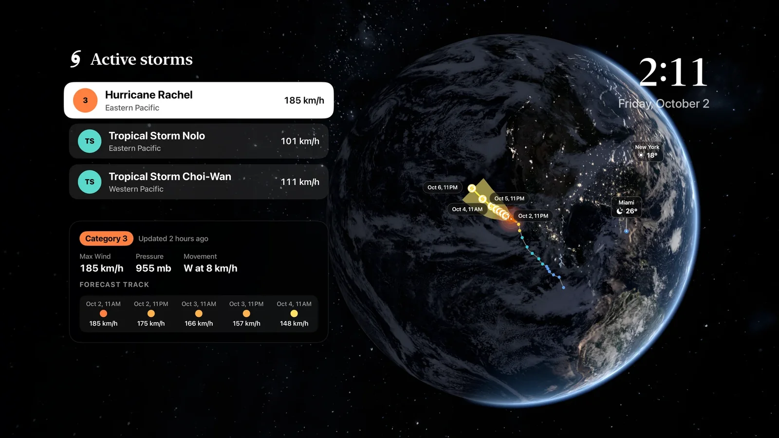
- On the Earth tab, active tropical storms carry a label with their name, class and strongest winds.
- Tap a storm and the Earth flies to it. The card shows pressure, movement and the forecast track, point by point, with the cone of uncertainty.
- The storm sits over its own live clouds, so you can see the real structure beneath the marker.
- On Apple TV, the Storms panel lists every active storm for the big screen.
- Alerts can tell you about tropical cyclones and official warnings for the places you watch.
For a step-by-step walkthrough, see how to track hurricanes on a 3D globe. And always follow the instructions of your local emergency services: an app shows you the storm, and they tell you when to leave.
Common questions
What wind speed is a Category 5 hurricane?
A Category 5 hurricane has sustained winds of 252 km/h (157 mph) or more. There is no Category 6: the scale is open-ended at the top.
What is the difference between a hurricane, a typhoon and a cyclone?
They are the same kind of storm with different regional names. Hurricane is used in the Atlantic and eastern Pacific, typhoon in the western Pacific, and cyclone in the Indian Ocean and South Pacific.
What does the cone of uncertainty mean?
The cone shows where the centre of the storm is likely to travel. Historically the centre stays inside the cone about two thirds of the time. It does not show the size of the storm, and dangerous wind, rain and surge often extend far outside it.
Is a Category 1 hurricane dangerous?
Yes. Category 1 winds can bring down trees and power lines, and a slow-moving Category 1 or even a tropical storm can cause catastrophic flooding. Many deadly storms were not major hurricanes.
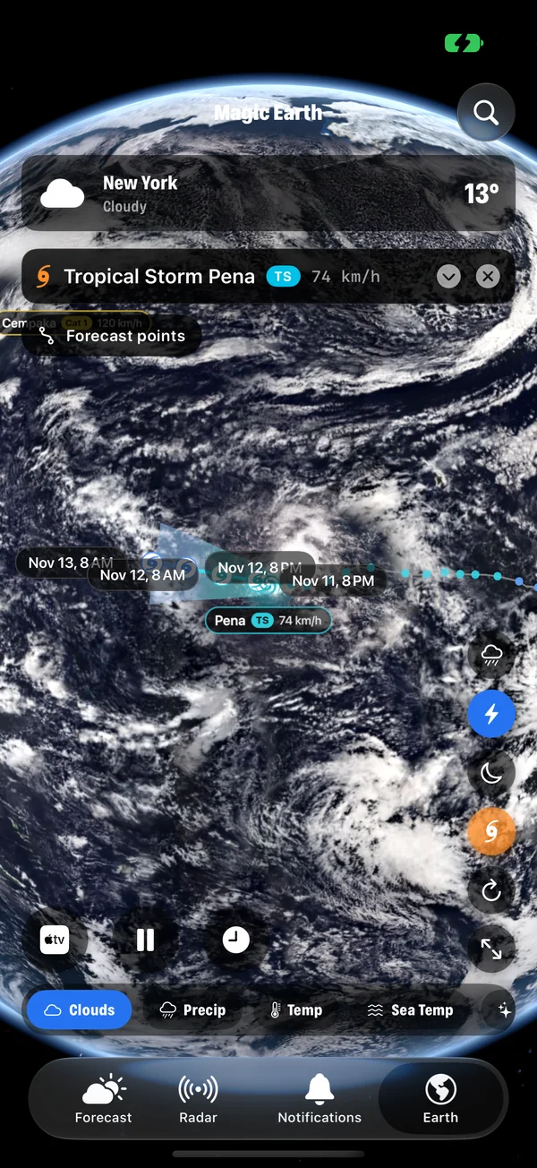
How to track hurricanes and tropical storms on a 3D globe
Follow every active hurricane, typhoon and tropical storm on a live 3D Earth with Magic Weather: track, cone, wind and pressure on iPhone, Mac and Apple TV.
Barometric pressure and weather: what a falling barometer means
Falling pressure means unsettled weather is on the way; rising pressure means it is clearing. Learn what the numbers mean and how fast is fast.
Wind speed vs wind gusts: which number should you plan around?
Wind speed is an average over minutes; a gust is a peak lasting seconds. Learn the difference, the Beaufort scale, and which number to plan around.