Open the Earth tab in Magic Weather. Active tropical storms appear on the globe with a label showing their name, category and wind speed. Tap a label and the Earth flies to the storm. Tap More on its card to see the central pressure, the direction it is moving, and the forecast track point by point with the cone of uncertainty.
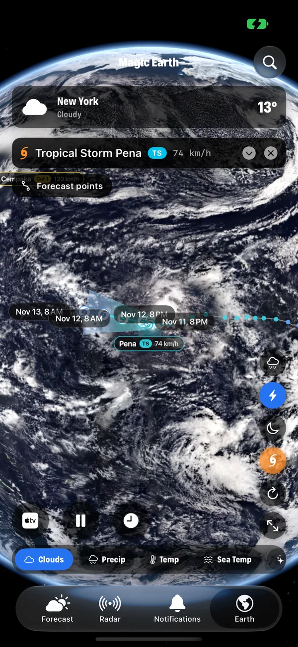
Find the active storms
- Open the Earth tab.
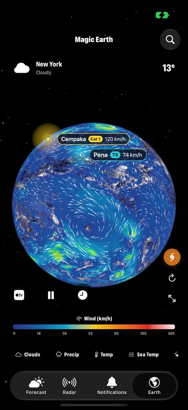
- Look for the labels on the globe. Each active tropical storm has one, showing its name, its class (such as TS for a tropical storm or Cat 1 for a hurricane) and its strongest winds.
- Drag the globe to look around, and pinch to zoom.
If you do not see any labels, either there are no active storms or storm markers are switched off. The storm button on the right side of the Earth tab shows or hides the markers and tracks.
Follow one storm
- Tap a storm's label. The Earth flies to it.
- Read the card at the top: name, class and strongest winds.
- Tap More to open the full card: central pressure, the direction and speed it is moving, and the forecast track, point by point.
- Look at the globe. The storm's current position sits over its own live clouds, so you can see its real size and structure.
- Tap Close to go back to the whole Earth.
How to read what you see
| On screen | What it means |
|---|---|
| The class | The storm's strength by wind: tropical depression, tropical storm, then categories 1 to 5. What each category means. |
| Wind speed | The strongest sustained wind near the centre, in your units. |
| Pressure | The central pressure. Lower means stronger. A falling value means the storm is intensifying. |
| Movement | Which way the storm is heading and how fast. A slow storm brings more rain to the places it crosses. |
| The track | Where the storm has been, and where it is expected to go. |
| Forecast points | Positions along the track with their times. A button shows or hides them. |
| The cone | The area the centre is likely to stay within. It widens with time. |
Three things to keep in mind
- The cone is about the centre, not the size. Dangerous wind and rain reach far beyond it. This is where the live clouds help: you can see how wide the storm really is.
- The centre leaves the cone about one time in three. A place just outside it is not safe.
- Water is the main danger. Storm surge and flooding cause most deaths, and neither is measured by the category.
Add layers for the full picture
While following a storm, switch the Earth layer to see what is driving it.
- Wind shows the circulation around the storm and how far the strong winds reach.
- Pressure shows the low at its centre and the highs that are steering it.
- Sea Temp shows the warm water the storm feeds on. Tropical storms need sea surface temperatures of about 26.5 °C (80 °F) or more.
- Precip shows where the rain bands are.
Get told when a storm forms
In the Notifications tab, the Hurricanes tile has a switch for each ocean basin: Atlantic, Eastern Pacific, Central Pacific and Western Pacific. Switch on the ones that matter to you. Official warnings for the places you watch arrive through the Official alerts tile.
How to set up severe weather alerts.
On the big screen
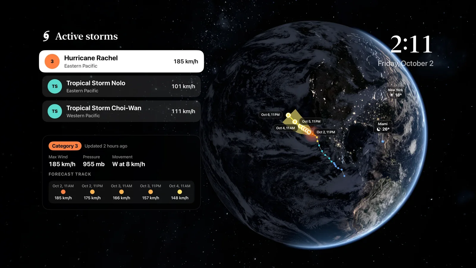
- Apple TV: the Storms panel lists the active storms. Pick one and the Earth flies to it, with its category, winds, pressure, movement and forecast points, and how close it will come to your cities.
- Mac: the Earth tab works the same way, in a window as large as you like.
- AirPlay: on iPhone, the Apple TV button on the Earth tab sends the globe to a TV, drawn at the TV's own sharpness.
What the app is for, and what it is not
Magic Weather shows you where a storm is, how strong it is and where it is forecast to go. It does not replace your national hurricane centre or your local emergency services. If you are in the path of a storm, follow official warnings and evacuation orders. They are based on surge and flood risk for your exact location, which no global map can show.
Common questions
Can I track hurricanes on my iPhone?
Yes. In Magic Weather, the Earth tab shows every active tropical storm on a 3D globe. Tap one to see its category, winds, pressure and forecast track.
Does it show typhoons and cyclones as well?
Yes. Hurricanes, typhoons and tropical cyclones are the same kind of storm under different regional names, and active storms are shown wherever they are in the world.
What does the cone around the track mean?
It shows where the centre of the storm is likely to go. It widens with time because the forecast is less certain further ahead. It does not show the size of the storm: wind, rain and surge reach well outside it.
Can I watch a hurricane on my TV?
Yes. The Apple TV app has a Storms panel that lists active storms and flies the Earth to the one you choose. You can also send the Earth from your iPhone to a TV with AirPlay.
Hurricane categories explained: what Category 1 to 5 really mean
Hurricane categories measure wind speed only. See the full Saffir-Simpson scale, what the cone of uncertainty shows, and why water is the bigger danger.
Every Earth layer in Magic Weather, explained
Clouds, rain, temperature, wind, pressure, sea temperature, aurora, UV, ozone, satellites, earthquakes and fires: what each Magic Weather layer shows.
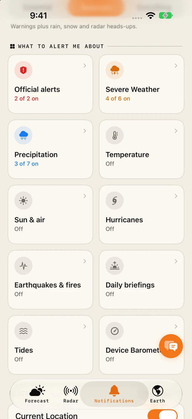
Severe weather alerts on iPhone: how to set them up properly
Set up severe weather alerts on iPhone with Magic Weather: official warnings, storms, lightning, wind and hurricanes, for home and every place you watch.