Open the Earth tab and use the row along the bottom to switch layers. Clouds, Precip, Temp and Sea Temp are always in the row. The sparkle button opens the rest: wind, pressure, aurora, UV, ozone, satellites, earthquakes, fires and the solar system. On any data layer, tap the globe to read the value at that point.
How layers work
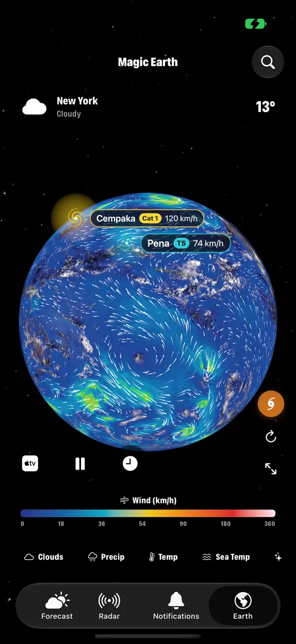
- The row along the bottom switches the layer. The active one is highlighted.
- The scale under the globe shows what the colours mean and the unit.
- Tap anywhere on a data layer to read the value at that point.
- Drag to spin the Earth. Pinch to zoom from the whole planet down to your region.
- Search (top right) finds any city and flies to it.
The four in the row
Clouds
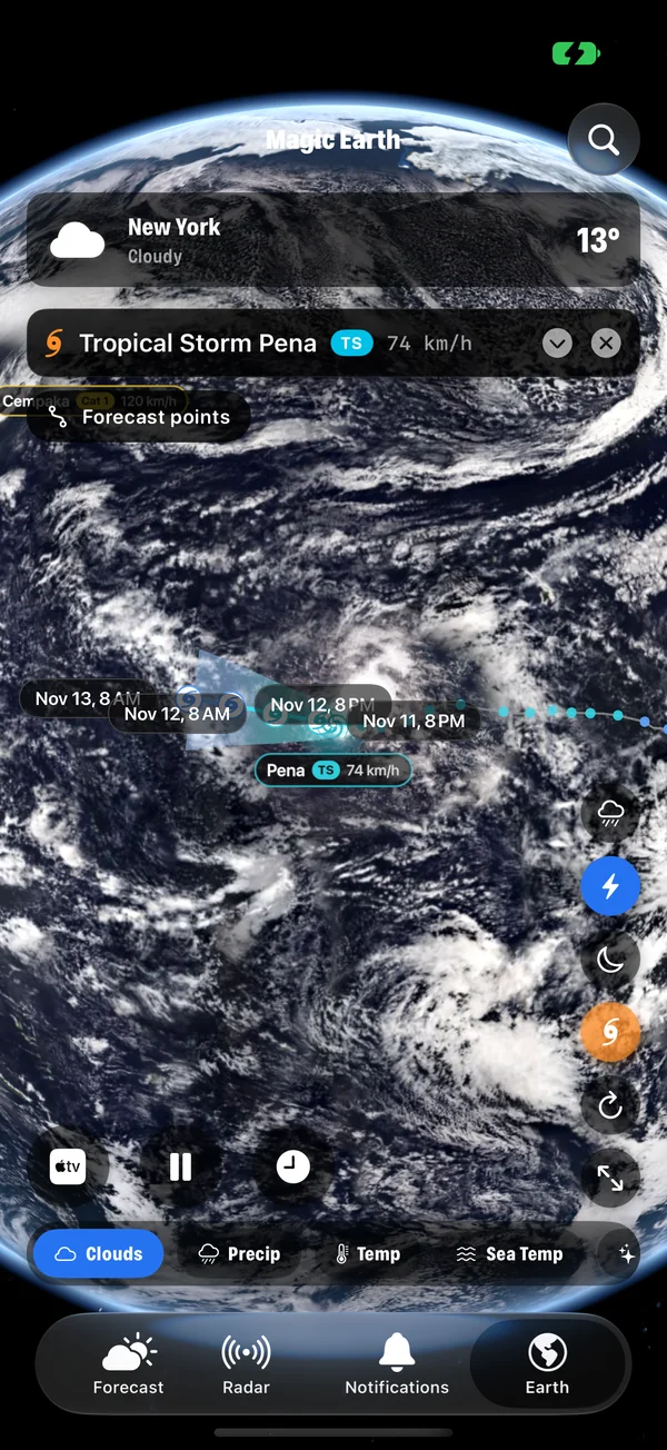
The default. The globe wears real clouds from satellite imagery, with day and night in their true positions. This is the layer for seeing weather systems as shapes: the comma of a low, the line of a front, the spiral of a tropical storm. How those pictures are made.
Precip
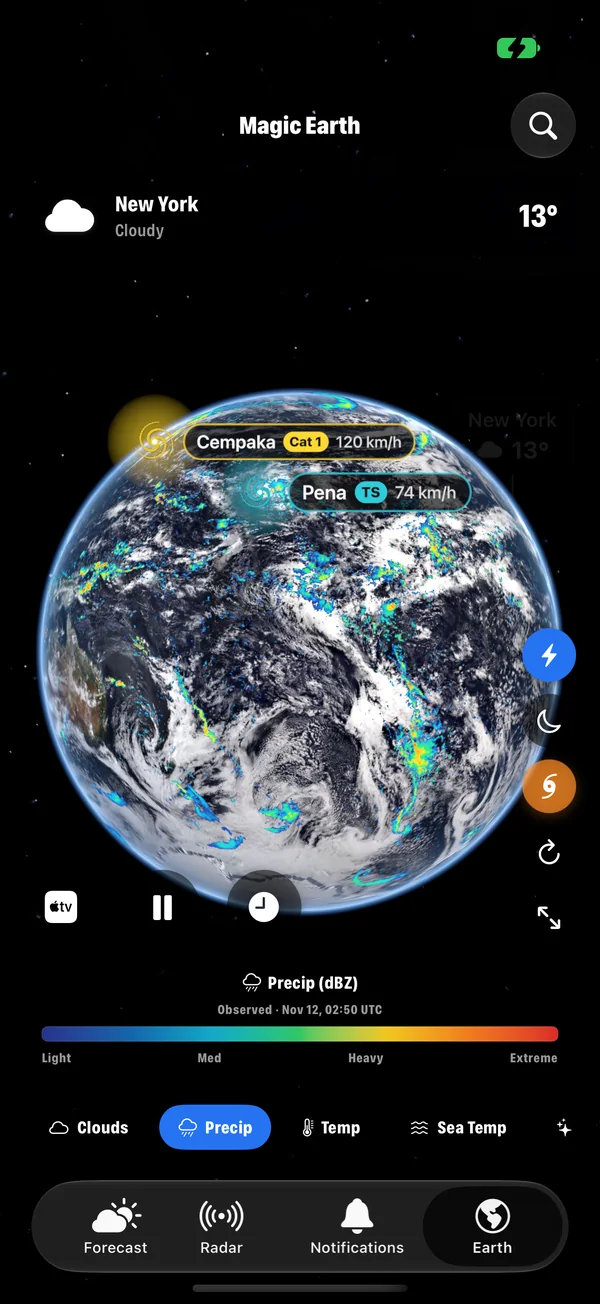
Where it is raining or snowing, coloured from light to extreme. Use it to see how big a rain area is and where its heavy core lies. A button on the side can also add rain on top of the Clouds layer, so you see both at once.
Temp
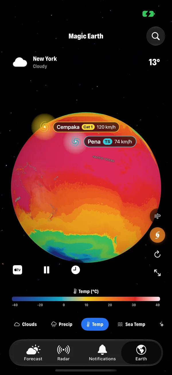
Air temperature near the ground, from deep blue for cold through green and yellow to red for hot. Look for the sharp colour boundaries: those are fronts, and the weather changes where they pass.
Sea Temp
The temperature of the sea surface. It changes slowly and steers a lot of weather: warm water feeds tropical storms, and the pattern along the equatorial Pacific is the signature of El Niño and La Niña. An ocean panel shows the current El Niño reading. El Niño and La Niña explained.
Behind the sparkle button
Wind
Wind speed and flow across the planet. The streaks follow the direction of the air, so circulations are easy to see: clockwise or anticlockwise swirls around highs and lows, the trade winds along the tropics, and the tight ring around a storm. Reading wind speed and gusts.
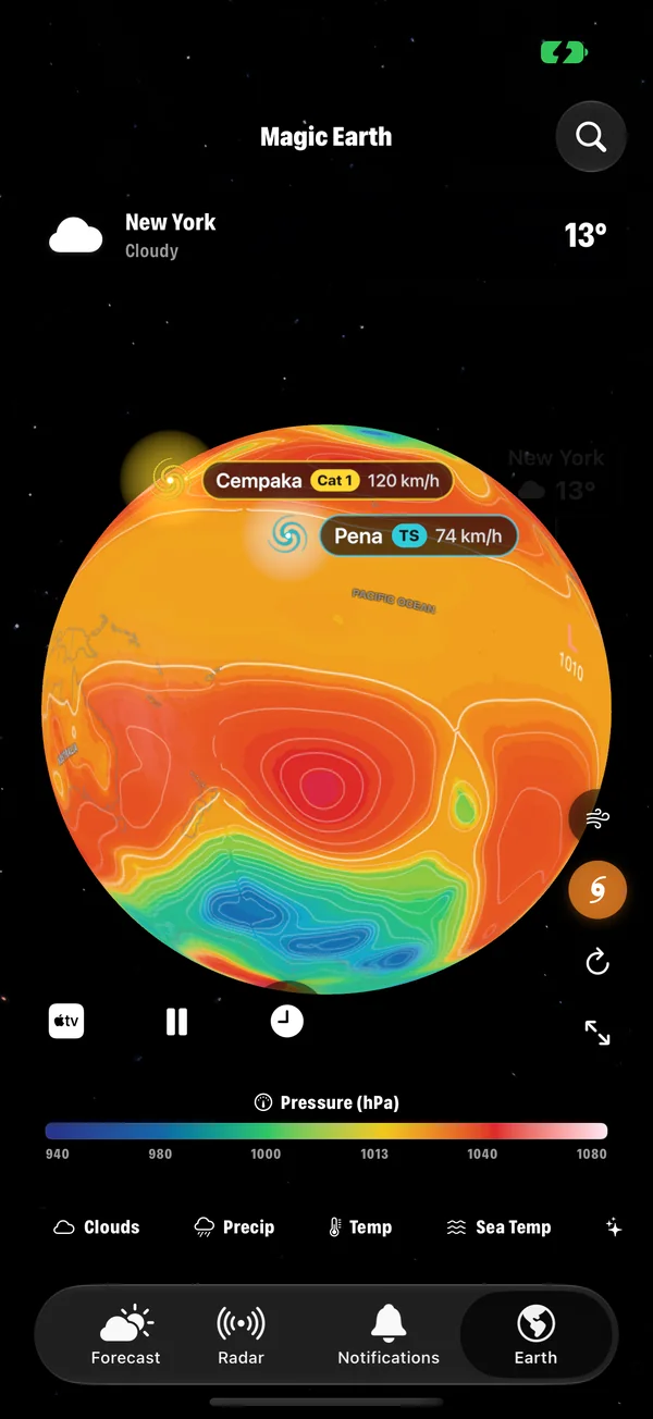
Pressure
Sea-level pressure in hectopascals. Lows are where the weather is unsettled, highs are where it is calm. Where the colours change quickly over a short distance, the wind is strong. What pressure tells you.
Aurora
The current chance of aurora, drawn as the oval around each pole. Check how far it reaches toward you, then switch to Clouds to see whether your sky is clear. The Kp index explained.
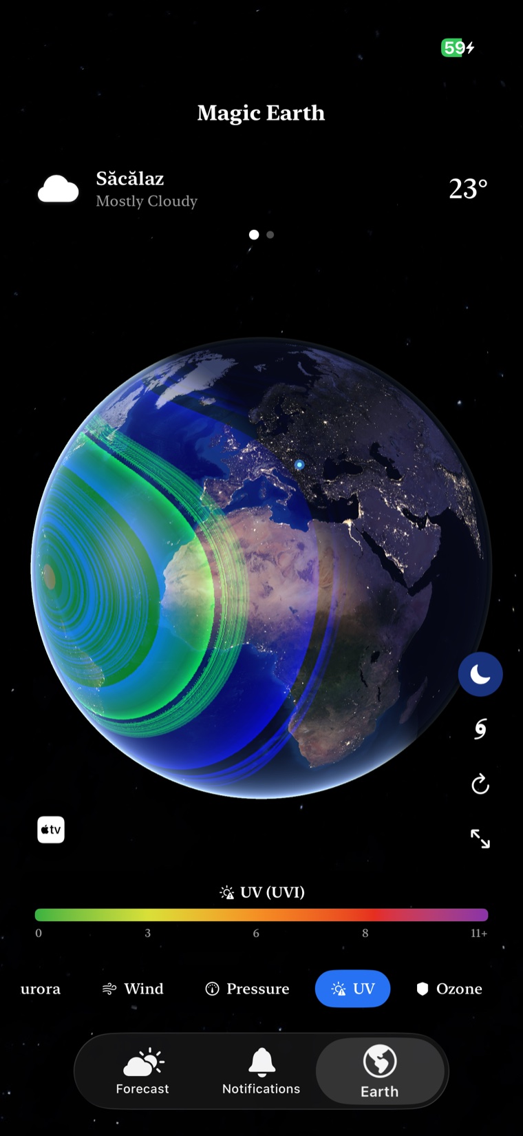
UV
The strength of ultraviolet radiation. The band of high UV follows the sun across the planet through the day. The UV index explained.
Ozone
The thickness of the ozone layer, in Dobson units. Ozone absorbs most of the sun's harmful ultraviolet light. This layer shows where it is thick and where it is thin, including the seasonal ozone hole over Antarctica.
Satellites
Spacecraft in orbit around the Earth, shown where they are now.
Earthquakes
Recent earthquakes around the world. The pattern traces the edges of the tectonic plates.
Fires
Active fires detected from space. Useful for understanding sudden haze or poor air quality downwind.
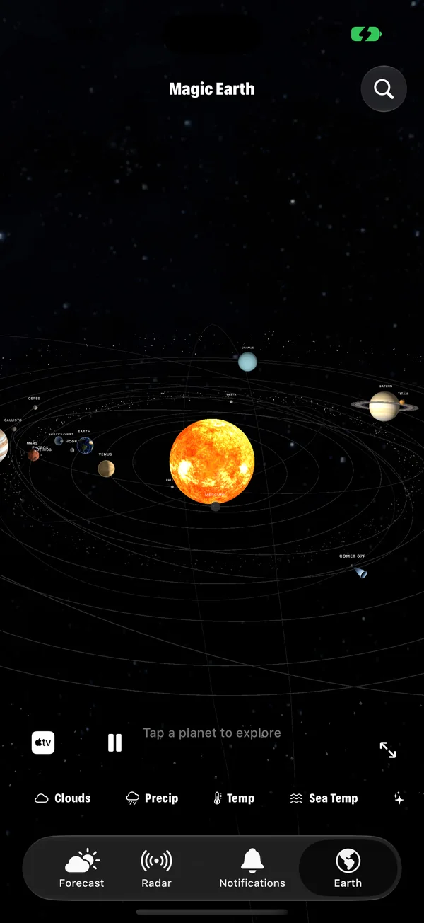
Solar System
Leaves the Earth altogether and shows the sun and planets on their orbits. Tap a planet to explore it.
The buttons down the side
| Button | What it does |
|---|---|
| Rain on the clouds | Adds where it is raining right now on top of the cloud picture. |
| Lightning | Shows live lightning flashes on the globe. |
| Day and night | Shows the real night side, with city lights. |
| Storms | Shows or hides storm markers and tracks. |
| Refresh | Fetches the latest pictures and data. |
| Full screen | Only the Earth, nothing else. |
Along the bottom left are three more: Apple TV sends the Earth to your TV over AirPlay, Pause stops or resumes the slow turn, and Nightstand turns the Earth into a bedside clock.
Layers that work well together
- Clouds, then Pressure. See a cloud system, then see the low that is making it.
- Wind, then Temp. See where the air is coming from, then how warm it is.
- Aurora, then Clouds. Is the oval over you, and can you see the sky?
- Sea Temp, then storms. See the warm water a hurricane is feeding on. How to track storms.
Free and Premium
Clouds and basic Earth viewing are free. The additional layers are part of Premium, which is shared across iPhone, iPad, Mac and Apple TV.
Common questions
How do I change the layer on the Earth?
Use the row of buttons along the bottom of the Earth tab. Clouds, Precip, Temp and Sea Temp are in the row, and the sparkle button at the end opens the others.
How do I read the value at a place?
On a data layer such as Temp, Wind or Pressure, tap anywhere on the globe. The app shows the value at that point. The scale under the globe shows what the colours mean.
Are all layers free?
Clouds and basic Earth viewing are free. Additional layers are part of Premium.
Do the layers work on Apple TV and Mac?
Yes. The Mac app has the same Earth tab, and the Apple TV app offers the same layers on the big screen.
How to track hurricanes and tropical storms on a 3D globe
Follow every active hurricane, typhoon and tropical storm on a live 3D Earth with Magic Weather: track, cone, wind and pressure on iPhone, Mac and Apple TV.
How weather satellites photograph the whole Earth
Two kinds of satellite watch the weather: one hovers 36,000 km up, the other sweeps pole to pole. Here is how their pictures become a cloud map.
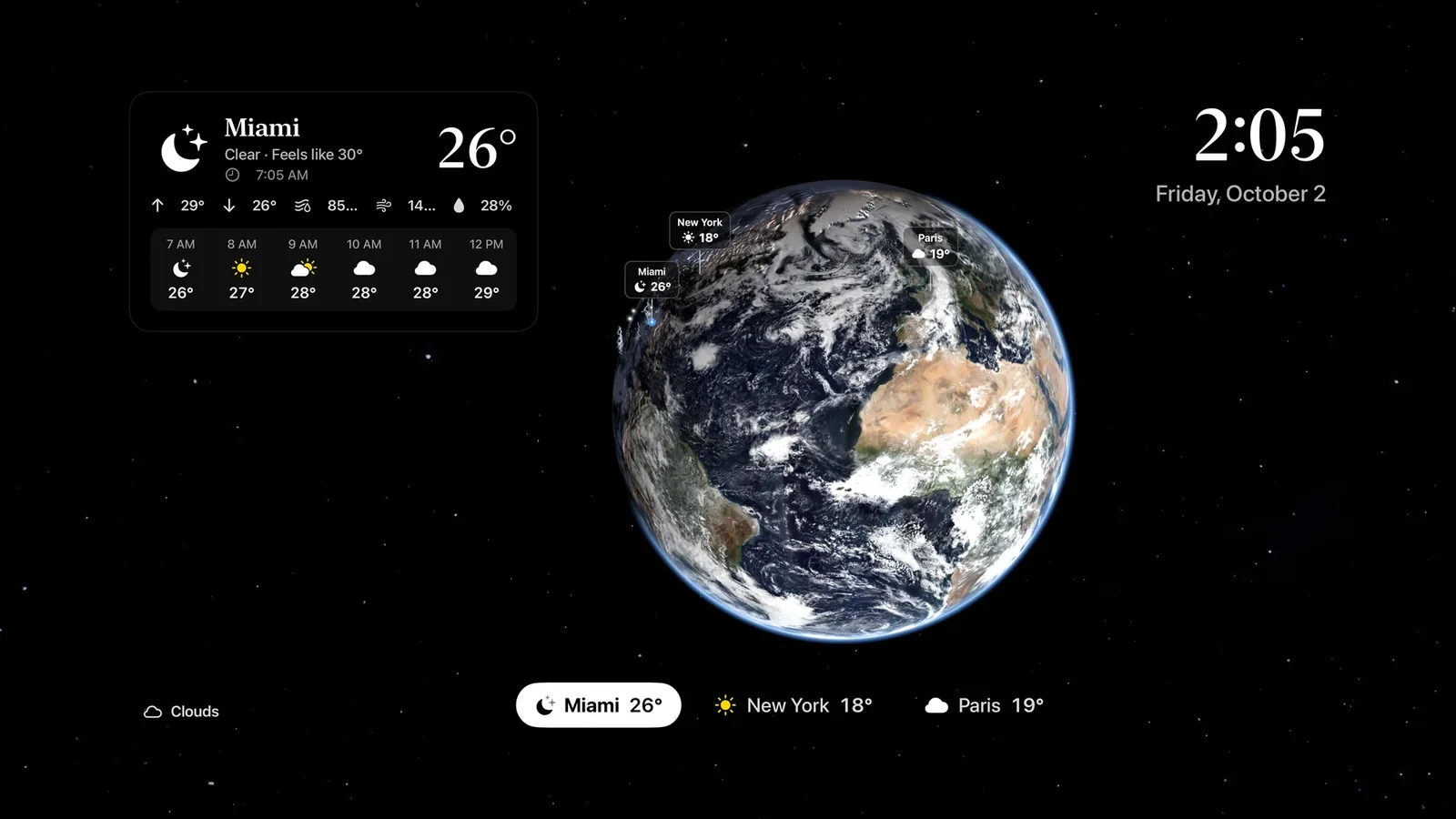
A live Earth on your TV: the Magic Weather Apple TV app
Put a photoreal, slowly turning Earth with real clouds on your TV. A guide to the Magic Weather Apple TV app: layers, storms, cities, sounds and the remote.