
Weather satellites come in two kinds. Geostationary satellites sit 35,786 km above the equator and stay over the same spot, photographing one side of the planet every 10 minutes or so. Polar-orbiting satellites fly about 830 km up, pass over the poles, and scan the whole Earth in strips, covering every place twice a day in much finer detail. A global cloud map is stitched together from both.
Two orbits, two jobs
| Geostationary | Polar-orbiting | |
|---|---|---|
| Height | 35,786 km | About 830 km |
| Position | Fixed above one point on the equator | Circles from pole to pole, about 14 times a day |
| What it sees | One whole side of the Earth, all the time | A strip about 3,000 km wide beneath it |
| How often | Every 10 minutes, or faster for small areas | Each place about twice a day |
| Detail | Good near the equator, poor toward the poles | Sharp everywhere, including the poles |
| Best for | Watching weather move | Detailed global pictures and data for forecast models |
Geostationary: the fixed stare
At exactly 35,786 km above the equator, a satellite takes 24 hours to complete an orbit, the same time the Earth takes to turn once. From the ground it appears to hang motionless in the sky. This is also why a satellite dish never has to move.
From that height one satellite sees almost half the planet, and a ring of them covers the globe: the American GOES satellites over the Americas, Europe's Meteosat over Europe and Africa, Japan's Himawari over east Asia and Australia, and others over the Indian Ocean.
Because they never look away, they can take a new picture every few minutes. Every animated cloud loop you have seen, and every hurricane seen spinning toward a coast, comes from a geostationary satellite.
The price is distance and angle. They are a long way out, and they see high latitudes at a slant. Beyond roughly 60 degrees north or south the view becomes too stretched for detailed work.
Polar orbit: the scanner
A polar-orbiting satellite flies more than forty times closer, in an orbit that takes it almost over the poles every 100 minutes. While it circles, the Earth turns beneath it, so each pass covers a new strip a little further west.
Many of these orbits are sun-synchronous: the satellite crosses the equator at the same local time on every pass, such as early afternoon. That keeps the lighting consistent from one day to the next.
After about 14 orbits, one satellite has seen the entire planet in daylight. Put the strips side by side and you have a single cloud-covered globe: a mosaic that looks like one photograph but was taken over 24 hours. The NASA "Blue Marble" style images of a whole sunlit Earth are made this way.
Why a global picture has seams
- Clouds move between passes. Neighbouring strips are 100 minutes apart, so a storm at the edge of one may not line up with the next.
- The date line join. The first and last strips of a day sit side by side but were taken nearly 24 hours apart. The weather on either side of that line can look quite different.
- Sun glint. Where the sea reflects the sun straight back at the sensor, each strip can show a bright stripe.
- Polar night. In winter the pole has no daylight, so there is nothing for a visible-light camera to see there.
- Gaps. If a satellite misses an orbit, the strip is empty until another fills it in.
Good imagery is processed to hide these, by blending strips and filling gaps from other satellites.
More than photographs
Satellites measure far more than visible light.
- Infrared shows cloud-top temperature, day and night. Cold tops mean tall clouds, and the coldest mark the most violent storms.
- Water vapour channels reveal moisture in clear air and trace the jet stream.
- Microwave sensors see through cloud to measure rain, sea ice and the temperature of the air at different heights.
- Lightning mappers on the newest geostationary satellites record flashes across a whole hemisphere.
- Other instruments measure sea surface temperature, ozone, smoke, dust and the wind over the ocean.
Most of this never becomes a picture. It is fed straight into forecast models, where satellite data now does more to improve forecast accuracy than any other kind of observation.
Satellite versus radar
A satellite looks down at the tops of clouds. Radar looks sideways from the ground at the rain inside them. Satellite shows where cloud is, including over oceans with no radar. Radar shows where and how hard it is actually raining. The two together are the full picture.
The satellite Earth in Magic Weather
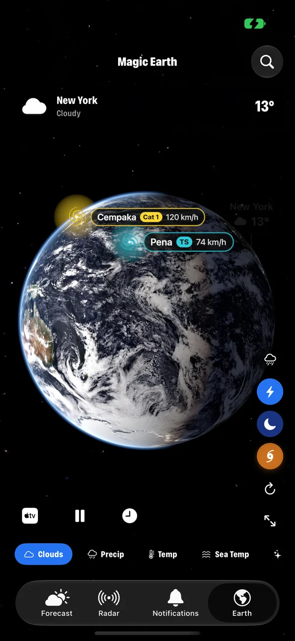
- The Clouds layer wraps the globe in satellite cloud imagery. Drag to spin it and pinch to zoom from the whole planet down to your region.
- Day and night follow the real position of the sun, with city lights on the dark side.
- Rain on the clouds adds where it is raining right now on top of the picture.
- Storms are shown over their own live clouds.
- A Satellites layer is among the extra layers, along with aurora, UV, ozone, earthquakes and fires.
- The Earth widget puts the planet, with your place on it, on your Home Screen.
For a tour of every layer, see the Earth layers explained.
Common questions
How high are weather satellites?
Geostationary weather satellites orbit 35,786 km above the equator. Polar-orbiting weather satellites fly much lower, at about 830 km.
How often do weather satellites take pictures?
Modern geostationary satellites image their whole side of the Earth every 10 minutes, and selected regions as often as every minute or less. A polar-orbiting satellite passes over any given place about twice a day.
How do satellites see clouds at night?
With infrared sensors, which measure heat rather than reflected sunlight. Cloud tops are colder than the ground, so they stand out day and night. The colder the cloud top, the higher and usually the more active the cloud.
Why do global satellite images have lines or seams?
A global picture from polar-orbiting satellites is assembled from about 14 strips taken over 24 hours. Clouds move between passes, so neighbouring strips do not match exactly, and the first and last strips, taken a day apart, meet at a visible join.
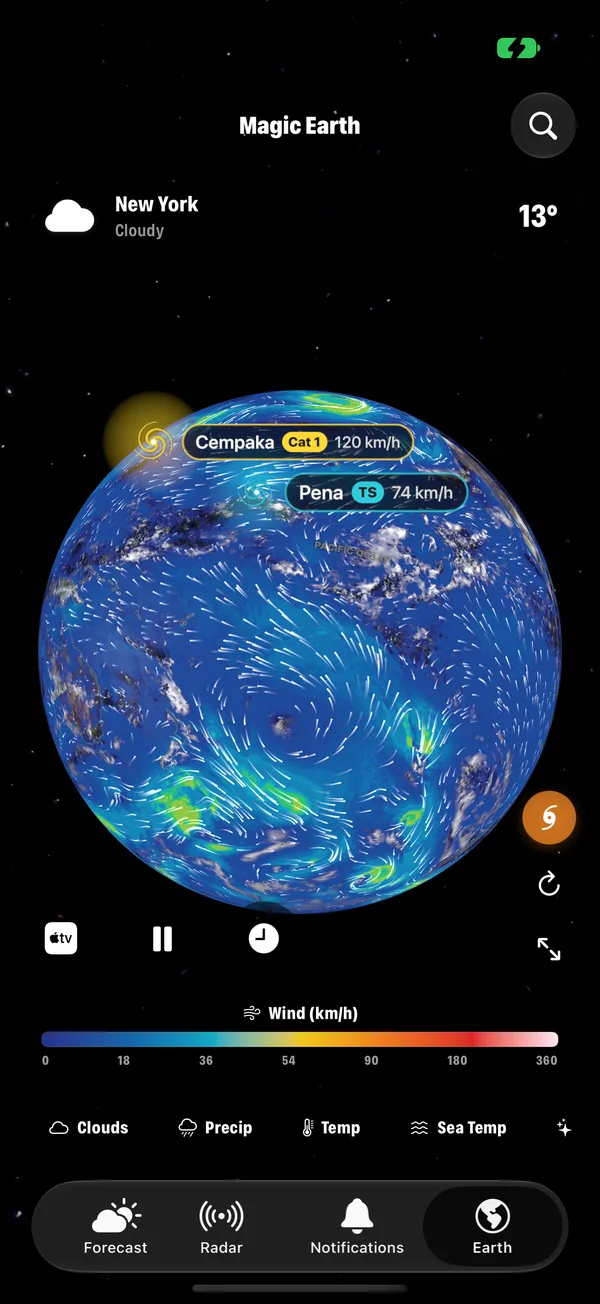
Every Earth layer in Magic Weather, explained
Clouds, rain, temperature, wind, pressure, sea temperature, aurora, UV, ozone, satellites, earthquakes and fires: what each Magic Weather layer shows.
How to read weather radar: colours, movement and what radar misses
Radar colours show how hard it is raining, and the loop shows where the rain is heading. Learn to read both, and the blind spots every radar has.
The Kp index and aurora forecasts: when can you see the northern lights?
The Kp index rates geomagnetic activity from 0 to 9. See what Kp you need at your latitude, plus the sky conditions that matter just as much.