Radar colours show rain intensity: blue and green are light, yellow is moderate, orange and red are heavy, and purple or white usually means hail or extreme rain. To see when rain will reach you, play the loop, note the direction and speed of the echoes, and extend that line to your location. Radar is most reliable for the next one to two hours.
How radar sees rain
A weather radar sends out short pulses of microwave energy and listens for the echo. Raindrops, snowflakes and hailstones scatter some of that energy back. The time the echo takes tells the radar how far away the precipitation is, and the strength of the echo tells it how much there is.
The dish turns a full circle, tilts up a little, and turns again. A few minutes later it has scanned the sky out to 200 kilometres or more. National weather services combine many radars into a single picture, and that mosaic is what you see in an app.
What the colours mean
Echo strength is measured in dBZ, decibels of reflectivity. Bigger drops and more of them give a higher number. Every map uses its own palette, so check the legend, but the order is nearly always the same.
| dBZ | Typical colour | What is falling |
|---|---|---|
| 5–20 | Light blue | Drizzle or very light rain. May not reach the ground. |
| 20–30 | Green | Light rain. You need a jacket, not shelter. |
| 30–40 | Yellow | Moderate rain. Roads are wet, wipers on. |
| 40–50 | Orange | Heavy rain. Poor visibility when driving. |
| 50–60 | Red | Very heavy rain, usually a thunderstorm. Small hail possible. |
| 60+ | Purple or white | Extreme rain or hail. Take cover. |
Snow reflects less than rain, so a snowfall that looks light on radar can still be heavy on the ground.
Reading movement: the part that matters
A still radar image tells you where the rain is. The loop tells you where it is going.
- Play the last hour. Watch which way the echoes travel. Ignore the wind at ground level, rain moves with the wind higher up.
- Pick one edge and follow it. See how far the leading edge of the rain moves between frames.
- Extend the line. If the edge covered 30 kilometres in the last hour and is 15 kilometres from you, you have about half an hour.
- Watch the shape. Is the area growing, shrinking or holding? Showers in summer can appear and vanish within 30 minutes. A wide band attached to a front is far more predictable.
Shapes worth recognising
- A wide, even band of green and yellow is a front. Steady rain for an hour or more, then it clears.
- Scattered blobs are showers. You may be soaked while the next street stays dry.
- A thin line of red is a squall line. Brief, intense rain with strong gusts, often with lightning.
- A hook or comma shape on the edge of an intense cell can mark a rotating storm. Follow official warnings.
- A spiral with a clear centre is a tropical cyclone. See hurricane categories explained.
What radar misses
Radar is a remarkable instrument with a few well-known blind spots.
- The beam climbs. Because the Earth curves, the beam is higher above the ground the farther it travels. At 150 kilometres it may be looking 3 kilometres up and overshoot low drizzle entirely.
- Virga. Rain seen high up can evaporate in dry air before reaching you. The radar says rain, your pavement says no.
- Mountains block the beam and leave gaps behind them.
- Clutter. Hills, buildings, wind farms, flocks of birds and swarms of insects all produce echoes. Good services filter most of it out.
- No radar at all. Large parts of the oceans and many countries have no ground radar. There, rain is estimated from satellites, which is less precise.
- It is the past. The newest frame is usually five to fifteen minutes old. A good app tells you how old.
Radar versus the forecast
Use radar for the next hour or two and the forecast for everything after that. They also answer different questions: radar shows where rain is, while a chance of rain tells you how likely it is to form in the first place.
Radar in Magic Weather
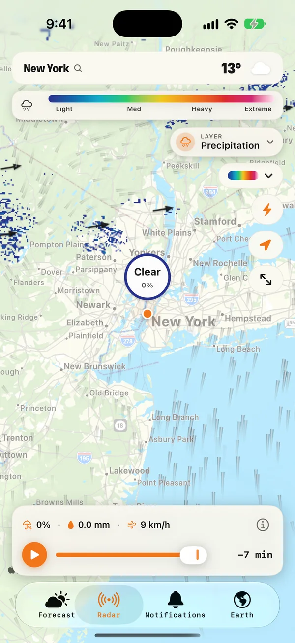
- Play runs the radar loop, and you can drag the timeline to step through the frames. A label shows how old each picture is.
- Tap anywhere on the map to read the rain chance, amount and wind at that exact spot.
- The legend shows what the colours mean, from light to extreme, and you can choose the palette you read most easily.
- Lightning can be switched on to show live strikes on the map.
- Other layers: the same map can show wind, temperature, pressure, air quality, sea wind and sea temperature.
- On the Earth tab, you can add where it is raining right now on top of the cloud picture.
If you would rather be told than look, set up rain alerts and let the app watch the radar for you.
Common questions
What do the colours on weather radar mean?
They show how strongly rain, snow or hail reflects the radar beam, measured in dBZ. Blue and green are light precipitation, yellow is moderate, orange and red are heavy, and purple or white indicates extreme rain or hail.
Why does radar show rain when it is dry outside?
The radar beam climbs with distance, so far from the radar it sees rain high in the sky that may evaporate before reaching the ground. This is called virga. Radar can also pick up ground clutter, insects and wind farms.
How far ahead can radar predict rain?
Following echoes on a radar loop gives a reliable picture for about one to two hours. Beyond that, showers grow, fade and change direction, and a forecast model is the better guide.
What does dBZ mean?
dBZ stands for decibels of reflectivity. It measures how much of the radar's energy is bounced back by precipitation. Around 20 dBZ is light rain, 40 dBZ is heavy rain, and above 55 dBZ usually means hail.
What does a 40% chance of rain actually mean?
A 40% chance of rain does not mean it rains 40% of the day or over 40% of the area. Here is the real definition, and how to plan around the number.
How far away is lightning? Count the seconds
Count the seconds between the flash and the thunder and divide by three for kilometres, or five for miles. Plus the 30-30 rule and where to shelter.
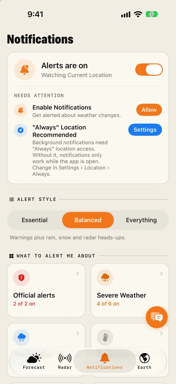
How to get rain alerts on your iPhone before it starts
Set up rain alerts on iPhone with Magic Weather: a notification before rain starts and stops, a Live Activity that follows the shower, and fixes if none arrive.