Weather apps disagree because they get their forecasts from different computer models, which start from slightly different data, divide the world into grids of different sizes and update at different times. They can also be forecasting for slightly different points near you. When apps agree, confidence is high. When they disagree, the weather is uncertain, and that is useful to know.
Where a forecast comes from
Almost no weather app makes its own forecast. A handful of government agencies and forecasting centres run enormous computer models that simulate the atmosphere. Apps buy or download that output and present it.
The best-known global models are the American GFS, the European ECMWF model, the German ICON and the British Met Office model. On top of these sit regional models that cover one country or continent in much finer detail.
So when two apps disagree, you are usually looking at two different models.
Five reasons the numbers differ
1. Different models
Every model starts from its own best estimate of the current state of the atmosphere and uses its own approximations for clouds, rain and the ground. Small differences at the start grow over time, which is why forecasts diverge more the further ahead you look.
2. Different grid sizes
A model divides the world into boxes and computes one value for each. Global models use boxes roughly 9 to 25 kilometres across. Regional models go down to 1 to 3 kilometres.
A coarse grid cannot see a single valley, a coastline or a thunderstorm. If you live between the sea and the hills, a fine regional model and a coarse global one can disagree by several degrees every day.
3. Different update times
Models run two to four times a day, and some regional ones every hour. One app may be showing a forecast made at midnight while another has the 6 AM run. The newer run has seen six more hours of real weather.
4. A different "you"
The app has to decide which point it is forecasting for. It may use the nearest grid point, the nearest weather station, the centre of your town, or your exact coordinates. In hilly or coastal places, two points five kilometres apart can have different weather.
5. Different processing
Many providers adjust raw model output using statistics from past errors, blend several models, or apply machine learning. They also make different choices about presentation: when a 30% chance becomes a rain icon, how feels-like is calculated, whether "today's high" means the calendar day or the daylight hours.
What the disagreement tells you
Disagreement between apps is information. Meteorologists use the same idea on purpose: they run a model dozens of times with slightly different starting points and see how far the results spread. This is called an ensemble.
| What you see | What it means |
|---|---|
| Two sources agree | The situation is well understood. Plan with confidence. |
| Same weather, different timing | A front or band of rain is coming. Only its speed is uncertain. Allow a few hours either way. |
| One shows showers, the other nothing | Scattered showers are possible. Check the radar on the day. |
| Completely different days | The models have not settled. Look again tomorrow. |
How to choose a source for where you live
- Test it. For two weeks, note which source got tomorrow's rain and temperature right for your home. Local quirks matter more than global rankings.
- Prefer fine detail for the short term. Regional models are usually better for the next two days, especially for showers and in hilly terrain.
- Prefer global models for the long term. For days four to seven, the big global models are the ones designed for the job.
- Use observations for right now. For the next hour, radar and live station readings beat any model.
- Trust official warnings. Alerts from your national weather service are written by forecasters who have looked at every model. They outrank any app's icon.
Choosing a provider in Magic Weather
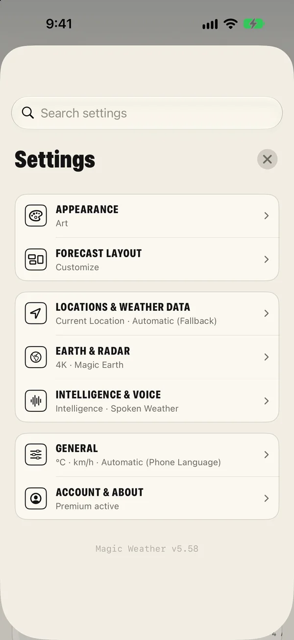
- Pick a provider. In Settings › Locations & weather data you can choose which forecast engine the app uses.
- Or leave it on Automatic. The app picks a provider and falls back to another if one fails, so you always have a forecast.
- Compare. If a day looks uncertain, switch providers and see whether the story changes. Two that agree are worth more than one.
- Live sources stay live. The radar, lightning and official alerts do not depend on the forecast provider you chose.
Common questions
Which weather app is the most accurate?
No single app or model is best everywhere. Accuracy depends on your region, the season and the kind of weather. The most reliable approach is to compare two sources: where they agree you can be confident, and where they differ the weather is uncertain.
Why does the forecast change every time I look?
Forecast models run again several times a day with newer observations. Each run can shift the timing of a front or a shower. Frequent changes for a particular day are a sign that the models are unsure about it.
Why is the temperature in my app different from my car or my thermometer?
A weather app shows a temperature for a standard height of two metres in the shade, interpolated between stations or model grid points. A car sensor sits near hot tarmac and an engine, and a home thermometer may be in sun or near a wall.
What are GFS and ECMWF?
They are two of the main global forecast models. GFS is run by the United States weather service and ECMWF by a European forecasting centre. Many apps are built on one of them, sometimes blended with regional models.