
A cold front is where colder air pushes under warmer air. It moves fast and brings a short burst of heavy rain or thunderstorms, a gusty wind shift, a drop in temperature and then clearer, fresher air. A warm front is where warmer air rides up over colder air. It moves slowly and brings thickening cloud and hours of steady light rain, followed by milder, muggier air.
Air masses and the lines between them
An air mass is a huge body of air, often over a thousand kilometres across, that has taken on the temperature and moisture of where it formed: cold and dry over a continent in winter, warm and humid over a tropical sea. Air masses do not mix easily. Where two meet, there is a boundary called a front.
Fronts are named for the air that is advancing. If colder air is pushing in, it is a cold front. If warmer air is pushing in, it is a warm front. In the mid-latitudes they usually come as a pair, wrapped around a low-pressure system: first the warm front, then a few hours to a day later the cold front.
Side by side
| Warm front | Cold front | |
|---|---|---|
| What happens | Warm air slides gently up over cold air | Cold air wedges under warm air and lifts it sharply |
| Speed | Slow | Fast, often twice as fast |
| Warning signs | High, thin cloud a day ahead, then a halo round the sun or moon, then lowering grey cloud | Tall, dark cloud building on the horizon, often with little warning |
| Rain | Light to moderate, steady, for hours | Heavy, short, sometimes with thunder and hail |
| Wind | Gradual change | Sudden gusty shift |
| Pressure | Falls steadily ahead, then levels off | Falls, then jumps up as the front passes |
| Afterwards | Milder, more humid, often grey | Cooler, drier, clearer, with showers possible |
A warm front, hour by hour
- A day ahead: wisps of high cirrus cloud spread across a blue sky.
- Half a day ahead: they thicken into a milky veil. The sun or moon may show a ring, or halo.
- A few hours ahead: the cloud lowers and greys. The pressure is falling steadily.
- The front: light rain or drizzle sets in and lasts for hours. In winter it may start as snow or freezing rain.
- After: the rain eases, the air feels milder and damper, and the cloud often stays low.
A cold front, hour by hour
- Ahead: the air is warm and often humid. The wind may strengthen from the south or south-west (in the Northern Hemisphere).
- As it nears: a dark wall of cloud builds on the horizon. The pressure is falling.
- The front: a short burst of heavy rain, sometimes thunder, hail and strong gusts. The wind swings round, often to the west or north-west.
- Right after: the temperature drops, sometimes by several degrees within an hour. The pressure starts to rise.
- Behind it: clearing skies, fresh air and good visibility, with scattered showers. The following night is often clear and cold.
Two more kinds
- Occluded front: the faster cold front catches up with the warm front and lifts the warm air off the ground. It brings cloud and rain with features of both, and marks a low that is mature and starting to weaken.
- Stationary front: neither air mass is winning, so the boundary barely moves. It can bring days of cloud and rain to the same area.
How fronts show up in a forecast
- On a meteogram: a cold front is a burst of tall rain bars followed by a step down in the temperature line that ignores the day-night rhythm. A warm front is a long run of low rain bars under a grey sky.
- On radar: a cold front is a narrow band or line, often with red and orange cores. A warm front is a wide, even area of green and yellow.
- On a barometer: a steady fall, then for a cold front a sharp turn upward as it passes.
- On a temperature map: a sharp boundary where the colours change over a short distance.
- In rain chances: fronts give high chances in a narrow window. Scattered showers give middling chances for hours.
Fronts in Magic Weather
- The weathergraph shows the burst of rain and the temperature step as the front passes.
- Weather Trends flags the pressure drop and the rain in the days ahead.
- The Radar tab shows the band of rain approaching, and the loop shows how fast.
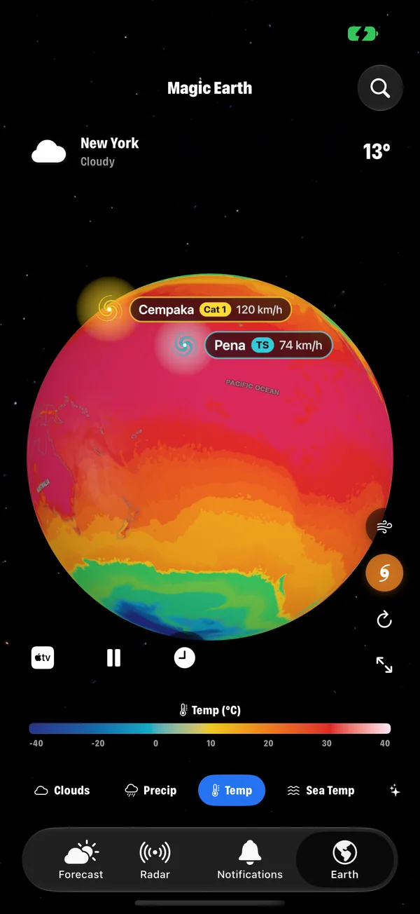
- The Earth tab shows the whole system: the comma of cloud on the Clouds layer, the boundary on the Temp layer, and the low on the Pressure layer.
- The barometer storm alert on iPhone can warn you as the pressure falls ahead of a strong front. How it works.
Common questions
What is the difference between a cold front and a warm front?
A cold front is where colder air advances and pushes warm air up sharply, giving short, heavy rain and a quick change. A warm front is where warmer air advances and slides gently over cold air, giving long, steady rain and a slow change.
What weather comes after a cold front?
Usually clearer skies, cooler and drier air, a wind that has turned (to the north-west in much of the Northern Hemisphere) and rising pressure. Showers can follow for a while, and the clear night afterwards is often cold.
Do cold fronts cause thunderstorms?
Often. A cold front lifts warm, moist air quickly, which can build tall shower and thunderstorm clouds along the front, sometimes as a squall line.
What is an occluded front?
Where a fast cold front catches up with a warm front and lifts the warm air off the ground. It brings a mix of the two: cloud and rain, often in a band that slowly fades.